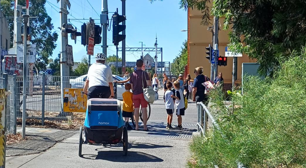
The Brunswick Level Crossing Removal Project (LXRP) – or Skyrail – will remove level crossings on eight roads, and will include separated walking and cycling paths. This project will provide a massive improvement for people walking and cycling along the corridor. People who walk or cycle will also be very happy that they will no longer have to share a narrow path. But what about where the Upfield walking and cycling paths intersect with the roads? How will the skyrail project facilitate walking and cycling, and not just driving?
Walking and cycling have been identified as the priority transport modes at seven of the eight intersections. It is only at the intersection of Brunswick Road and the Upfield line that both general traffic and active transport are identified as priority modes. (Brunswick Road is the only arterial road of the eight.) However, Albion Street, Victoria Street, Dawson Street and Brunswick Road also carry buses, which are also a priority.
Indeed, cyclists are already the main road users at two of the intersections (Hope Street and Union Street – see below). The population of Brunswick will increase significantly, and the planning scheme is now discouraging car ownership. So we will get more people walking and cycling along or across the Upfield, and they are likely to become the dominant road users at most of of the intersections.
So what do we know about the current usage of the eight intersections, and Council’s plan for walking and cycling infrastructure? The recent project update and EES referral update has included a lot more information, including a consultant’s report on Transport Provisions. This contains useful data on how many people are walking, cycling and driving for each intersection of the eight roads and the Upfield shared path.
The LXRP’s traffic counts for motor vehicles crossing the Upfield line are shown below. These are the number of vehicles per day. Interestingly they add to nearly 80,000 vehicles per day, which is significantly higher than the 71,000 vehicles per day they originally estimated.
- Albion Street: 8,600
- Hope Street: 5,500
- Victoria Street: 9,400
- Albert Street: 7,500
- Dawson Street: 14,300
- Union Street: 4,200
- Brunswick Street: 17,200
- Park Street: 13,200
The report also includes counts of people walking, cycling and driving across the intersection per hour at peak times. (Walking and cycling counts are for both north-south and east-west.) The morning peak hour data is shown for each intersection in the pie charts below.
It is clear that cyclists are already the main road users of the intersections at Union Street and Hope Street. Even at most of the other intersections, the numbers of people walking and cycling are already comparable with those driving.
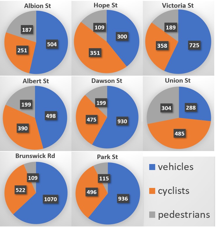
In these counts of road users, pedestrians were moving east-west and north-south in roughly similar number. But most of the cyclists in these counts were travelling north-south along the Upfield shared path (which is a Strategic Cycling Corridor – see map here).
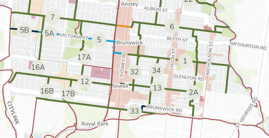
Safe east-west cycling routes are being created through the Council’s Streets for People Plan. The image from this plan shows the following routes crossing the Upfield line.
- No. 7: Hope St, Brunswick – Moonee Ponds Creek to Sydney Rd
- No. 5: Victoria St, Brunswick – Pearson Street to Sydney Road
- No. 1: Albert St, Brunswick – Upfield Line to Merri Creek
- No. 12: Union Street, Brunswick – Moonee Ponds Creek to Sydney Road
- No. 33: Park Street – Oak Street to Capital City Rail Trail
It is also useful to understand the different functions that different roads and streets play in our transport system. The Movement and Place framework includes the following types:
- Activity streets and boulevards are typically those with shops and services. They have a lot of people moving about on foot, or by bike and car. They include Sydney Road, Victoria Street, and part of Dawson Street.
- City Places have lots of pedestrians, and lower levels of vehicle movement. Most of the small streets between Sydney Road and the Upfield line are designated as city places.
- Local streets are quiet, mainly residential streets. They are intended for only local traffic. They including Union Street, Albert Street, Hope Street and Park Street.
- Connectors are the roads intended for through traffic. They include Brunswick Road, Albion Street, and Dawson Street (west of Fallon Street)
The categorisation of the streets and roads around the Upfield Line are shown below.
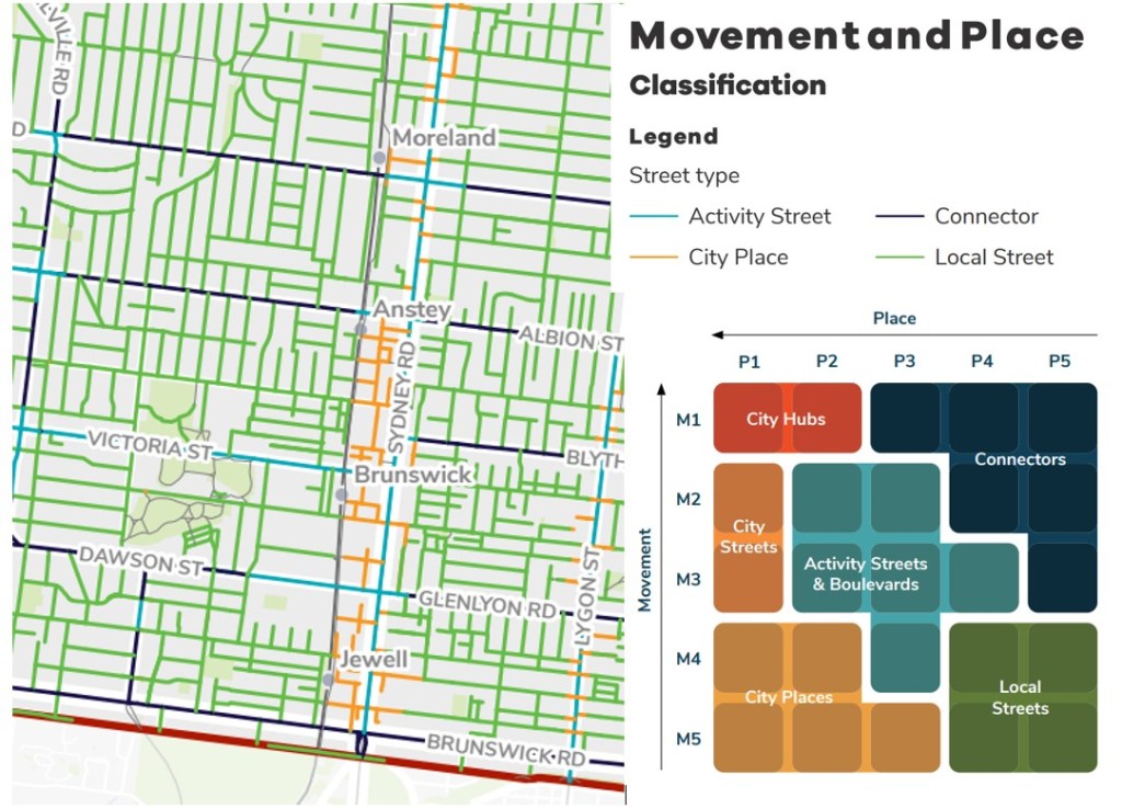
Only three roads crossing the Upfield are Connector roads, which are those mainly intended for through traffic. These are Albion Street, Brunswick Road and Dawson Street (which also has an activity centre function for part of it). These three roads have buses, as does Victoria Street.
It is concerning the the four local roads crossing the Upfield line carry so much traffic. (See vehicle counts earlier.) This suggests that current traffic management is not sufficient to deter through traffic.
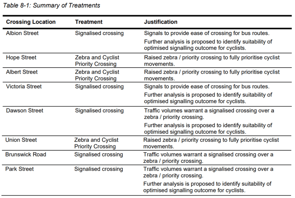
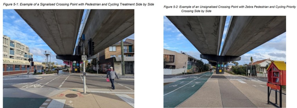
The types of crossings planned at each intersection is shown below. Note that “optimised signaling” for cyclists means the crossing “is fitted with advanced detectors along the bicycle lane, providing a predictive green light for approaching cyclists. This will increase instances where cyclists will be afforded uninterrupted movement along the route through the relevant crossings, minimising the need to stop at the crossing“.
Problem areas
We have identified some problem areas, and we are sure others will add to this list.
The LXRP are planning on-street pick-up / drop-off facilities on the northern side of both Union Street and Hope Street. Yet both these streets are intended for safe cycling corridors. We question whether the LXRP should be encouraging motor vehicle traffic on these streets. At pick-up and drop-off locations, motor vehicles pull in and out quickly. This creates a hazard for other road users, particularly on foot or bike. Indeed, schools are another example of this, and Council spends considerable effort trying to reduce the hazard.
The intersections of Albion Street, Victoria Street, Dawson Street, Brunswick Road and Park Street will have a signalised crossing – despite active transport being a priority at all except for Brunswick Road. The consultant’s report claims that “Further analysis is proposed to identify suitability of optimised signaling outcome for cyclists.” As described above “optimised signaling” means that approaching cyclists can trigger a change to green lights for cyclists crossing the road. However, its suitability is subject to further analysis. Otherwise, at signalised crossings, cyclists need to push the beg button and wait. Clearly we would want a quick response. The east-west buses (which are also a priority) plus the need to coordinate the traffic signals with those of Sydney Road will reduce the priority given to cyclists on the Upfield Line.
Park Street will be challenging. The Upfield Line must rise steeply, not only to meet the height difference from Royal Park, but also to ensure the Skyrail clears the road sufficiently. To ensure the Skyrail at Park Street doesn’t become another Montague Street Bridge, Park Street will be lowered at the Skyrail. They say that “the proposed treatment along Park Street will provide a traffic lane in each direction with kerbside bicycle lanes. Footpaths will be provided along either side of the road.” Moreover, “the east west service road and footpaths on the north side of Park Street will remain at grade”. Presumably this means that properties on Park St can be accessed with a footpath at grade, but those walking east-west will walk on a lowered footpath.
So at Park Street, the north-south walking and cycling paths along the Upfield Line will also have to be lowered so they can cross the road. People wanting to access Park Street will face a significant height difference. As yet we have no information on that will be handled.
Overall, it looks like the intersection of the Upfield Line and Park Street will be the one to watch, noting of course that active travel is meant to the be priority mode.
Consultation
The LXRP are holding information sessions in February 2026. You need to register.
In-person information sessions: T.O.M.S Place, 1 Tripovich Street, Brunswick 3056
Tuesday 24 February with sessions from 5.30pm to 8.15pm; and Thursday 26 February with sessions from 5.30pm to 8.15pm
Online information session via Zoom: This will have a presentation by the project team, followed by answers to any pre-submitted questions and a live Q A via the Zoom Q A function. Pre-submitted questions can be submitted upon registration for the session.
- Wednesday 11 February, 12.30pm to 1.30pm
- Monday 16 February, 6pm to 7pm
- Thursday 12 February, 6pm to 7pm
- Wednesday 18 February, 12.30pm to 1.30pm
More information here.
